
- Start >
- Groundwater >
- Waterlevel of upper layer >
- Bayern >
- Emmerting - B01 >
- Chart of total period

Chart of total period Emmerting - B01
Groundwater levels of the total period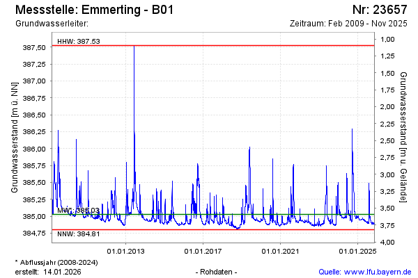
Groundwater level [m above sealevel]: 384.96
Distance to surface [m]: 3.66
Last value from 10.03.2026 09:00
Ground level [m above sealevel]: 388.62
| Date | Groundwater level [m above sealevel] |
|---|---|
| 10.03.2026 | 384.95 |
| 09.03.2026 | 384.93 |
| 08.03.2026 | 384.93 |
| 07.03.2026 | 384.94 |
| 06.03.2026 | 384.94 |
| 05.03.2026 | 384.95 |
| 04.03.2026 | 384.98 |
| 03.03.2026 | 385.00 |
© Bayerisches Landesamt für Umwelt 2026