
- Start >
- Groundwater >
- Waterlevel of upper layer >
- Bayern >
- ELSBETH / STADL 91 >
- Chart of total period

Chart of total period ELSBETH / STADL 91
Groundwater levels of the total period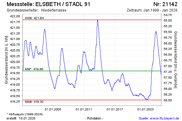
Groundwater level [m above sealevel]: 419.13
Distance to surface [m]: 57.68
Last value from 06.03.2026 09:00
Ground level [m above sealevel]: 476.81
| Date | Groundwater level [m above sealevel] |
|---|---|
| 06.03.2026 | 419.13 |
| 05.03.2026 | 419.13 |
| 04.03.2026 | 419.13 |
| 03.03.2026 | 419.14 |
| 02.03.2026 | 419.14 |
| 01.03.2026 | 419.14 |
| 28.02.2026 | 419.15 |
| 27.02.2026 | 419.15 |
© Bayerisches Landesamt für Umwelt 2026