
- Start >
- Groundwater >
- Waterlevel of upper layer >
- Bayern >
- EICHENDORF 342B >
- Chart of total period

Chart of total period EICHENDORF 342B
Groundwater levels of the total period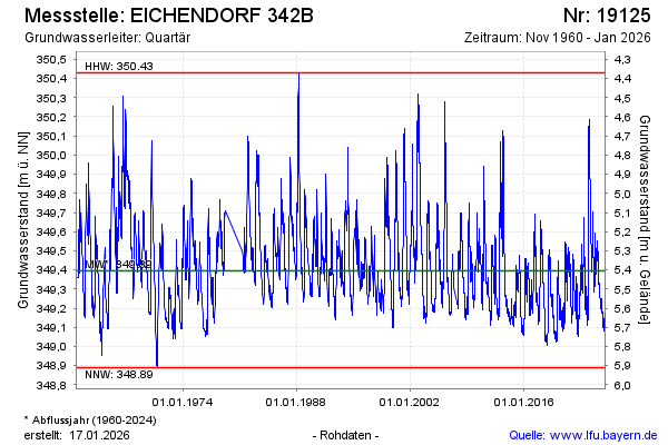
note
Wegen technischen Defekt keine tagesaktuellen Daten!
Groundwater level [m above sealevel]: 349.40
Distance to surface [m]: 5.40
Last value from 05.03.2026 13:00
Ground level [m above sealevel]: 354.80
| Date | Groundwater level [m above sealevel] |
|---|---|
| 05.03.2026 | 349.39 |
| 04.03.2026 | 349.39 |
| 03.03.2026 | 349.39 |
| 02.03.2026 | 349.39 |
| 01.03.2026 | 349.38 |
| 28.02.2026 | 349.37 |
| 27.02.2026 | 349.35 |
| 26.02.2026 | 349.33 |
© Bayerisches Landesamt für Umwelt 2026