
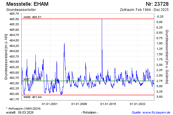
Chart of total period EHAM
Groundwater level [m above sealevel]: 402.53
Distance to surface [m]: 2.83
Last value from 15.03.2026 14:00
Ground level [m above sealevel]: 405.36
| Date | Groundwater level [m above sealevel] |
|---|---|
| 15.03.2026 | 402.53 |
| 14.03.2026 | 402.53 |
| 13.03.2026 | 402.54 |
| 12.03.2026 | 402.54 |
| 11.03.2026 | 402.55 |
| 10.03.2026 | 402.55 |
| 09.03.2026 | 402.55 |
| 08.03.2026 | 402.56 |