
- Start >
- Groundwater >
- Waterlevel of upper layer >
- Bayern >
- EBERSB.FORST 2 526 >
- Chart of total period

Chart of total period EBERSB.FORST 2 526
Groundwater levels of the total period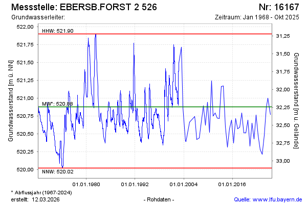
note
Beobachtung nur mehr halbjährlich.
Groundwater level [m above sealevel]: 520.52
Distance to surface [m]: 32.60
Last value from 14.10.2025 11:24
Ground level [m above sealevel]: 553.12
| Date | Groundwater level [m above sealevel] |
|---|---|
| 09.10.2024 | 521.00 |
| 17.04.2024 | 520.87 |
| 18.10.2023 | 520.48 |
| 01.10.2023 | -- |
| 30.09.2023 | -- |
| 29.09.2023 | -- |
| 28.09.2023 | -- |
| 27.09.2023 | -- |
© Bayerisches Landesamt für Umwelt 2026