
- Start >
- Groundwater >
- Waterlevel of upper layer >
- Bayern >
- DONAURIED-FRISTGN 837 >
- Chart of total period

Chart of total period DONAURIED-FRISTGN 837
Groundwater levels of the total period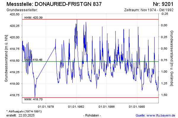
Groundwater level [m above sealevel]: 419.61
Distance to surface [m]: 0.65
Last value from 31.10.1992 11:40
Ground level [m above sealevel]: 420.26
| Date | Groundwater level [m above sealevel] |
|---|---|
| 29.10.1992 | 419.62 |
| 28.10.1992 | 419.44 |
| 27.10.1992 | 419.40 |
| 26.10.1992 | 419.39 |
| 25.10.1992 | 419.27 |
| 24.10.1992 | 419.19 |
| 21.10.1992 | 419.17 |
| 18.10.1992 | 419.15 |
© Bayerisches Landesamt für Umwelt 2025