
- Start >
- Groundwater >
- Waterlevel of upper layer >
- Bayern >
- Dollnstein >
- Current data

Current data Dollnstein
Groundwater levels of the last 12 months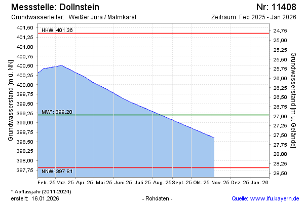
note
Datenübertragung Defekt. Zeitreihe wird mit Kontrollpunkten erzeugt.
Groundwater level [m above sealevel]: 399.39
Distance to surface [m]: 26.78
Last value from 13.04.2026 13:00
Ground level [m above sealevel]: 426.17
| Date | Groundwater level [m above sealevel] |
|---|---|
| 13.04.2026 | 399.39 |
| 12.04.2026 | 399.39 |
| 11.04.2026 | 399.39 |
| 10.04.2026 | 399.39 |
| 09.04.2026 | 399.39 |
| 08.04.2026 | 399.39 |
| 07.04.2026 | 399.39 |
| 06.04.2026 | 399.40 |
© Bayerisches Landesamt für Umwelt 2026