
- Start >
- Groundwater >
- Waterlevel of upper layer >
- Bayern >
- Dinkelsbühl-Waldeck >
- Year chart of precipitation

Year chart of precipitation Dinkelsbühl-Waldeck
Groundwater levels of the last 12 months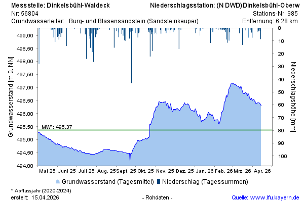
Groundwater level [m above sealevel]: 496,36
Distance to surface [m]: 7,46
Last value from 12.04.2026 13:00
Ground level [m above sealevel]: 503.82
© Bayerisches Landesamt für Umwelt 2026