
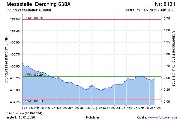
Current data DERCHING 638 A
Groundwater level [m above sealevel]: 464,91
Distance to surface [m]: 2,35
Last value from 23.07.2026 09:00
Ground level [m above sealevel]: 467.26
| Date | Groundwater level [m above sealevel] |
|---|---|
| 23.07.2026 | 464.91 |
| 22.07.2026 | 464.92 |
| 21.07.2026 | 464.92 |
| 20.07.2026 | 464.93 |
| 19.07.2026 | 464.93 |
| 18.07.2026 | 464.94 |
| 17.07.2026 | 464.94 |
| 16.07.2026 | 464.95 |