
- Start >
- Groundwater >
- Waterlevel of upper layer >
- Bayern >
- DERCHING 637 >
- Chart of total period

Chart of total period DERCHING 637
Groundwater levels of the total period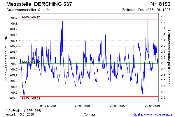
Groundwater level [m above sealevel]: 465.97
Distance to surface [m]: 2.44
Last value from 31.10.1995 23:59
Ground level [m above sealevel]: 468.41
| Date | Groundwater level [m above sealevel] |
|---|---|
| 06.10.1995 | 466.04 |
| 29.09.1995 | 466.07 |
| 23.09.1995 | 466.10 |
| 21.09.1995 | 466.09 |
| 20.09.1995 | 466.10 |
| 14.09.1995 | 466.14 |
| 03.09.1995 | 466.19 |
| 01.09.1995 | 466.17 |
© Bayerisches Landesamt für Umwelt 2026