
- Start >
- Groundwater >
- Waterlevel of upper layer >
- Bayern >
- DB-FAHRLEITUNGSBAU 36 >
- Current data

Current data DB-FAHRLEITUNGSBAU 36
Groundwater levels of the last 12 months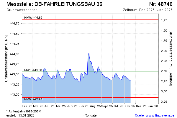
Groundwater level [m above sealevel]: 443.53
Distance to surface [m]: 2.55
Last value from 07.04.2026 10:00
Ground level [m above sealevel]: 446.08
| Date | Groundwater level [m above sealevel] |
|---|---|
| 07.04.2026 | 443.52 |
| 06.04.2026 | 443.49 |
| 05.04.2026 | 443.47 |
| 04.04.2026 | 443.46 |
| 03.04.2026 | 443.46 |
| 02.04.2026 | 443.47 |
| 01.04.2026 | 443.47 |
| 31.03.2026 | 443.46 |
© Bayerisches Landesamt für Umwelt 2026