
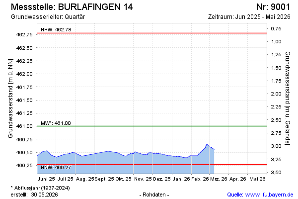
Current data BURLAFINGEN 14
note
Aktualisierung nur alle 3 Monate!
Groundwater level [m above sealevel]: 460,43
Distance to surface [m]: 3,19
Last value from 10.06.2026 09:51
Ground level [m above sealevel]: 463.62
| Date | Groundwater level [m above sealevel] |
|---|---|
| 10.06.2026 | 460.41 |
| 09.06.2026 | 460.42 |
| 08.06.2026 | 460.42 |
| 07.06.2026 | 460.42 |
| 06.06.2026 | 460.43 |
| 05.06.2026 | 460.43 |
| 04.06.2026 | 460.43 |
| 03.06.2026 | 460.43 |