
- Start >
- Groundwater >
- Waterlevel of upper layer >
- Bayern >
- Burk 23 >
- Chart of total period

Chart of total period Burk 23
Groundwater levels of the total period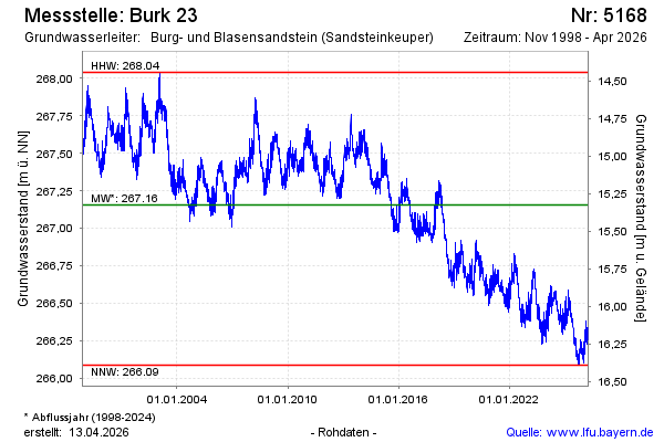
Groundwater level [m above sealevel]: 266.31
Distance to surface [m]: 16.17
Last value from 13.04.2026 08:00
Ground level [m above sealevel]: 282.48
| Date | Groundwater level [m above sealevel] |
|---|---|
| 13.04.2026 | 266.31 |
| 12.04.2026 | 266.30 |
| 11.04.2026 | 266.29 |
| 10.04.2026 | 266.28 |
| 09.04.2026 | 266.27 |
| 08.04.2026 | 266.26 |
| 07.04.2026 | 266.26 |
| 06.04.2026 | 266.27 |
© Bayerisches Landesamt für Umwelt 2026