
- Start >
- Groundwater >
- Waterlevel of upper layer >
- Bayern >
- Burgthann K 6 >
- Current data

Current data Burgthann K 6
Groundwater levels of the last 12 months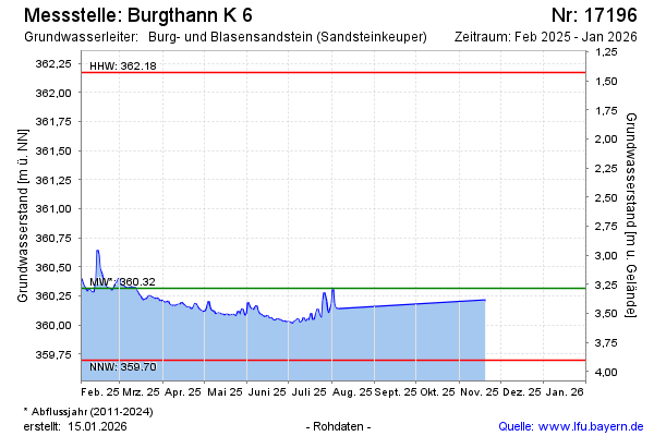
Groundwater level [m above sealevel]: 360.43
Distance to surface [m]: 3.17
Last value from 10.02.2026 10:15
Ground level [m above sealevel]: 363.60
| Date | Groundwater level [m above sealevel] |
|---|---|
| 20.01.2026 | 360.21 |
| 19.01.2026 | -- |
| 18.01.2026 | -- |
| 17.01.2026 | -- |
| 16.01.2026 | -- |
| 15.01.2026 | -- |
| 14.01.2026 | -- |
| 13.01.2026 | -- |
© Bayerisches Landesamt für Umwelt 2026