
- Start >
- Groundwater >
- Waterlevel of upper layer >
- Bayern >
- BURGHEIM 921 >
- Chart of total period

Chart of total period BURGHEIM 921
Groundwater levels of the total period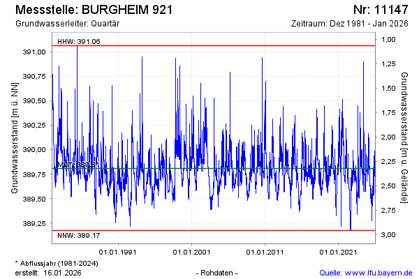
Groundwater level [m above sealevel]: 389.77
Distance to surface [m]: 2.36
Last value from 20.05.2026 09:00
Ground level [m above sealevel]: 392.13
| Date | Groundwater level [m above sealevel] |
|---|---|
| 20.05.2026 | 389.75 |
| 19.05.2026 | 389.73 |
| 18.05.2026 | 389.71 |
| 17.05.2026 | 389.72 |
| 16.05.2026 | 389.69 |
| 15.05.2026 | 389.63 |
| 14.05.2026 | 389.61 |
| 13.05.2026 | 389.66 |
© Bayerisches Landesamt für Umwelt 2026