
- Start >
- Groundwater >
- Waterlevel of upper layer >
- Bayern >
- BURGEBRACH 232 >
- Chart of total period

Chart of total period BURGEBRACH 232
Groundwater levels of the total period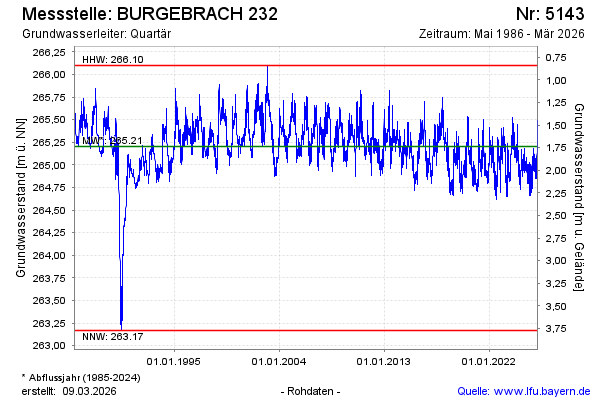
Groundwater level [m above sealevel]: 265.25
Distance to surface [m]: 1.69
Last value from 08.03.2026 09:00
Ground level [m above sealevel]: 266.94
| Date | Groundwater level [m above sealevel] |
|---|---|
| 08.03.2026 | 265.26 |
| 07.03.2026 | 265.27 |
| 06.03.2026 | 265.28 |
| 05.03.2026 | 265.30 |
| 04.03.2026 | 265.31 |
| 03.03.2026 | 265.33 |
| 02.03.2026 | 265.35 |
| 01.03.2026 | 265.37 |
© Bayerisches Landesamt für Umwelt 2026