
- Start >
- Groundwater >
- Waterlevel of upper layer >
- Bayern >
- Burgau HWS BGW 4 >
- Chart of total period

Chart of total period Burgau HWS BGW 4
Groundwater levels of the total period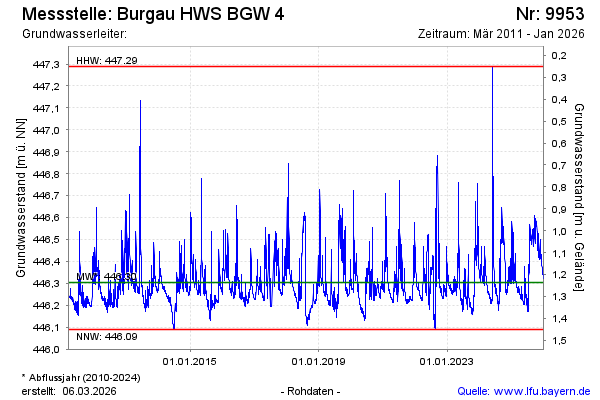
Groundwater level [m above sealevel]: 446.38
Distance to surface [m]: 1.16
Last value from 18.06.2024 09:06
Ground level [m above sealevel]: 447.54
| Date | Groundwater level [m above sealevel] |
|---|---|
| 18.06.2024 | 446.38 |
| 17.06.2024 | 446.39 |
| 16.06.2024 | 446.41 |
| 15.06.2024 | 446.44 |
| 14.06.2024 | 446.47 |
| 13.06.2024 | 446.50 |
| 12.06.2024 | 446.56 |
| 11.06.2024 | 446.64 |
© Bayerisches Landesamt für Umwelt 2024