
- Start >
- Groundwater >
- Waterlevel of upper layer >
- Bayern >
- BSM 4 SOB HWF >
- Chart of total period

Chart of total period BSM 4 SOB HWF
Groundwater levels of the total period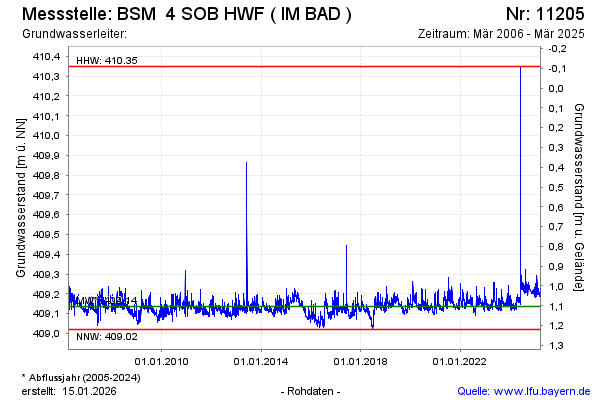
Groundwater level [m above sealevel]: 409.23
Distance to surface [m]: 1.01
Last value from 28.03.2025 12:00
Ground level [m above sealevel]: 410.24
| Date | Groundwater level [m above sealevel] |
|---|---|
| 28.03.2025 | 409.22 |
| 27.03.2025 | 409.23 |
| 26.03.2025 | 409.21 |
| 25.03.2025 | 409.22 |
| 24.03.2025 | 409.22 |
| 23.03.2025 | 409.20 |
| 22.03.2025 | 409.20 |
| 21.03.2025 | 409.19 |
© Bayerisches Landesamt für Umwelt 2026