
- Start >
- Groundwater >
- Waterlevel of upper layer >
- Bayern >
- BRANDSCHLAG 719 >
- Chart of total period

Chart of total period BRANDSCHLAG 719
Groundwater levels of the total period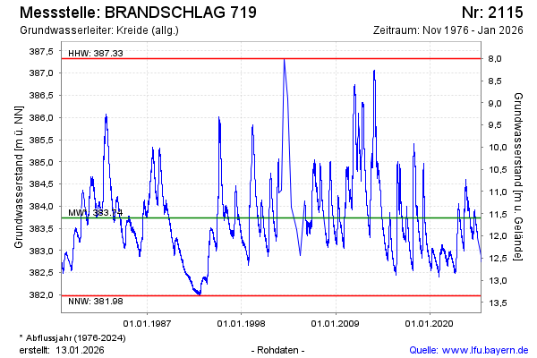
Groundwater level [m above sealevel]: 382.76
Distance to surface [m]: 12.57
Last value from 07.03.2026 04:00
Ground level [m above sealevel]: 395.33
| Date | Groundwater level [m above sealevel] |
|---|---|
| 06.03.2026 | 382.75 |
| 05.03.2026 | 382.74 |
| 04.03.2026 | 382.71 |
| 03.03.2026 | 382.70 |
| 02.03.2026 | 382.70 |
| 01.03.2026 | 382.68 |
| 28.02.2026 | 382.69 |
| 27.02.2026 | 382.69 |
© Bayerisches Landesamt für Umwelt 2026