
- Start >
- Groundwater >
- Waterlevel of upper layer >
- Bayern >
- BLUMENSTRASSE KO 39A >
- Chart of total period

Chart of total period BLUMENSTRASSE KO 39A
Groundwater levels of the total period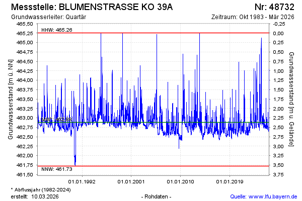
note
Die Messstelle musste 2009 verlegt werden !
Groundwater level [m above sealevel]: 463.45
Distance to surface [m]: 1.80
Last value from 04.03.2026 09:42
Ground level [m above sealevel]: 465.25
| Date | Groundwater level [m above sealevel] |
|---|---|
| 04.03.2026 | 463.47 |
| 03.03.2026 | 463.52 |
| 02.03.2026 | 463.60 |
| 01.03.2026 | 463.68 |
| 28.02.2026 | 463.77 |
| 27.02.2026 | 463.89 |
| 26.02.2026 | 464.05 |
| 25.02.2026 | 464.29 |
© Bayerisches Landesamt für Umwelt 2026