
- Start >
- Groundwater >
- Waterlevel of upper layer >
- Bayern >
- Blaibach Quelle 1-4 >
- Chart of total period

Chart of total period Blaibach Quelle 1-4
Groundwater levels of the total period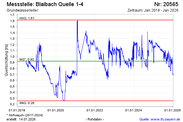
Groundwater level [m above sealevel]:
Distance to surface [m]:
Last value not current
Ground level [m above sealevel]: --
| Date | Groundwater level [m above sealevel] |
|---|---|
© Bayerisches Landesamt für Umwelt 2024