
- Start >
- Groundwater >
- Waterlevel of upper layer >
- Bayern >
- BK7-Urschlauer Ache >
- Chart of total period

Chart of total period BK7-Urschlauer Ache
Groundwater levels of the total period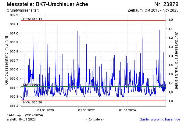
Groundwater level [m above sealevel]: 666.34
Distance to surface [m]: 1.81
Last value from 20.03.2026 10:34
Ground level [m above sealevel]: 668.15
| Date | Groundwater level [m above sealevel] |
|---|---|
| 20.03.2026 | 666.35 |
| 19.03.2026 | 666.34 |
| 18.03.2026 | 666.34 |
| 17.03.2026 | 666.35 |
| 16.03.2026 | 666.34 |
| 15.03.2026 | 666.35 |
| 14.03.2026 | 666.36 |
| 13.03.2026 | 666.37 |
© Bayerisches Landesamt für Umwelt 2026