
Chart of total period BIESELBACH 418B
Groundwater level [m above sealevel]: 459.63
Distance to surface [m]: 1.67
Last value from 02.06.2026 10:00
Ground level [m above sealevel]: 461.30
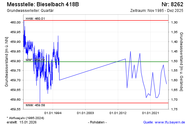
| Date | Groundwater level [m above sealevel] |
|---|---|
| 05.12.2024 | 459.72 |
| 02.07.2024 | 459.78 |
| 18.12.2023 | 459.74 |
| 14.06.2023 | 459.63 |
| 01.12.2022 | 459.61 |
| 20.06.2022 | 459.61 |
| 08.12.2021 | 459.68 |
| 22.07.2021 | 459.74 |