
- Start >
- Groundwater >
- Waterlevel of upper layer >
- Bayern >
- BETLINSH./ILLERTISS.K >
- Current data

Current data BETLINSH./ILLERTISS.K
Groundwater levels of the last 12 months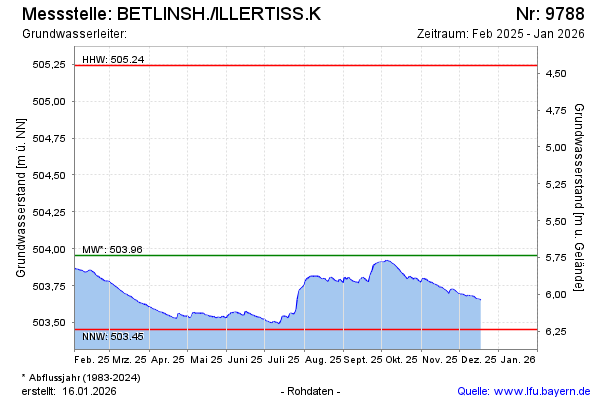
Groundwater level [m above sealevel]: 503.65
Distance to surface [m]: 6.04
Last value from 18.12.2025 10:17
Ground level [m above sealevel]: 509.69
| Date | Groundwater level [m above sealevel] |
|---|---|
| 18.12.2025 | 503.65 |
| 17.12.2025 | 503.66 |
| 16.12.2025 | 503.66 |
| 15.12.2025 | 503.66 |
| 14.12.2025 | 503.66 |
| 13.12.2025 | 503.67 |
| 12.12.2025 | 503.68 |
| 11.12.2025 | 503.68 |
© Bayerisches Landesamt für Umwelt 2026