
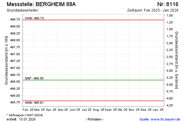
Current data BERGHEIM 88A
Groundwater level [m above sealevel]: 496.31
Distance to surface [m]: 3.59
Last value from 15.12.2025 10:00
Ground level [m above sealevel]: 499.90
| Date | Groundwater level [m above sealevel] |
|---|---|
| 04.12.2024 | 496.62 |
| 01.07.2024 | 496.94 |
| 14.12.2023 | 497.38 |
| 13.06.2023 | 496.44 |
| 01.12.2022 | 496.30 |
| 15.06.2022 | 496.23 |
| 09.12.2021 | 496.35 |
| 19.07.2021 | 497.05 |