
- Start >
- Groundwater >
- Waterlevel of upper layer >
- Bayern >
- BELLENBERG/MUEHLBACH A >
- Chart of total period

Chart of total period BELLENBERG/MUEHLBACH A
Groundwater levels of the total period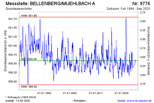
Groundwater level [m above sealevel]: 500.34
Distance to surface [m]: 4.34
Last value from 25.09.2025 07:50
Ground level [m above sealevel]: 504.68
| Date | Groundwater level [m above sealevel] |
|---|---|
| 18.10.2024 | 500.56 |
| 17.10.2024 | 500.56 |
| 16.10.2024 | 500.57 |
| 15.10.2024 | 500.57 |
| 14.10.2024 | 500.58 |
| 13.10.2024 | 500.58 |
| 12.10.2024 | 500.58 |
| 11.10.2024 | 500.59 |
© Bayerisches Landesamt für Umwelt 2026