
- Start >
- Groundwater >
- Waterlevel of upper layer >
- Bayern >
- Bellenberg, Illertaltangente, Unterflur >
- Current data

Current data Bellenberg, Illertaltangente, Unterflur
Groundwater levels of the last 12 months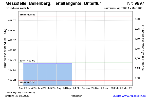
Groundwater level [m above sealevel]: 497.61
Distance to surface [m]: 3.18
Last value from 17.03.2026 13:55
Ground level [m above sealevel]: 500.79
| Date | Groundwater level [m above sealevel] |
|---|---|
| 16.10.2025 | 495.07 |
| 19.02.2025 | 497.56 |
| 19.09.2024 | 497.65 |
| 17.04.2024 | 497.65 |
| 05.09.2023 | 497.95 |
| 22.02.2023 | 497.43 |
| 01.09.2022 | 497.60 |
| 18.02.2022 | 497.54 |
© Bayerisches Landesamt für Umwelt 2026