
- Start >
- Groundwater >
- Waterlevel of upper layer >
- Bayern >
- BAYRISCHZELL BO.B >
- Chart of total period

Chart of total period BAYRISCHZELL BO.B
Groundwater levels of the total period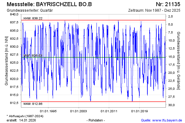
Groundwater level [m above sealevel]: 824.45
Distance to surface [m]: 17.44
Last value from 30.03.2026 10:36
Ground level [m above sealevel]: 841.89
| Date | Groundwater level [m above sealevel] |
|---|---|
| 30.03.2026 | 824.49 |
| 29.03.2026 | 824.67 |
| 28.03.2026 | 824.95 |
| 27.03.2026 | 825.22 |
| 26.03.2026 | 825.49 |
| 25.03.2026 | 825.74 |
| 24.03.2026 | 825.97 |
| 23.03.2026 | 826.21 |
© Bayerisches Landesamt für Umwelt 2026