
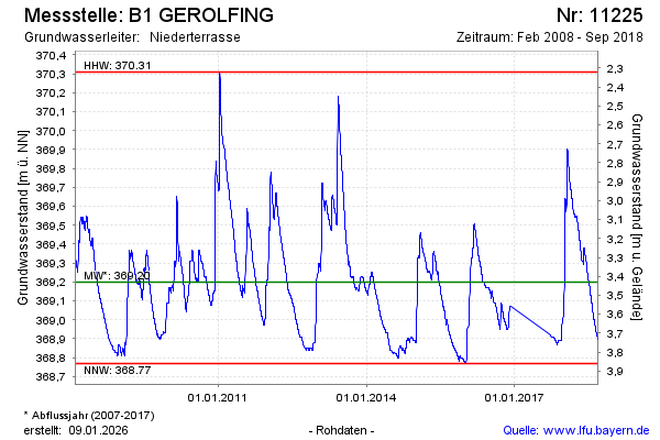
Chart of total period B1 GEROLFING
Groundwater level [m above sealevel]: 368.88
Distance to surface [m]: 3.75
Last value from 11.09.2018 13:00
Ground level [m above sealevel]: 372.63
| Date | Groundwater level [m above sealevel] |
|---|---|
| 11.09.2018 | 368.90 |
| 10.09.2018 | 368.90 |
| 09.09.2018 | 368.91 |
| 08.09.2018 | 368.91 |
| 07.09.2018 | 368.91 |
| 06.09.2018 | 368.91 |
| 05.09.2018 | 368.91 |
| 04.09.2018 | 368.91 |