
- Start >
- Groundwater >
- Waterlevel of upper layer >
- Bayern >
- B.WOERISHOFEN 493 >
- Chart of total period

Chart of total period B.WOERISHOFEN 493
Groundwater levels of the total period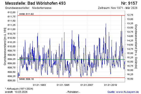
Groundwater level [m above sealevel]: 610.32
Distance to surface [m]: 14.28
Last value from 03.06.2024 00:00
Ground level [m above sealevel]: 624.60
| Date | Groundwater level [m above sealevel] |
|---|---|
| 02.06.2024 | 610.17 |
| 01.06.2024 | 609.80 |
| 31.05.2024 | 609.50 |
| 30.05.2024 | 609.48 |
| 29.05.2024 | 609.48 |
| 28.05.2024 | 609.48 |
| 27.05.2024 | 609.48 |
| 26.05.2024 | 609.47 |
© Bayerisches Landesamt für Umwelt 2024