
- Start >
- Groundwater >
- Waterlevel of upper layer >
- Bayern >
- Ay, Lusthauser Straße >
- Chart of total period

Chart of total period Ay, Lusthauser Straße
Groundwater levels of the total period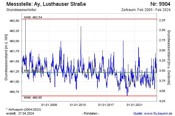
Groundwater level [m above sealevel]: 480.95
Distance to surface [m]: 3.82
Last value from 12.05.2026 13:43
Ground level [m above sealevel]: 484.77
| Date | Groundwater level [m above sealevel] |
|---|---|
| 12.05.2026 | 480.93 |
| 11.05.2026 | 480.91 |
| 10.05.2026 | 480.90 |
| 09.05.2026 | 480.90 |
| 08.05.2026 | 480.92 |
| 07.05.2026 | 480.93 |
| 06.05.2026 | 480.93 |
| 05.05.2026 | 480.93 |
© Bayerisches Landesamt für Umwelt 2026