
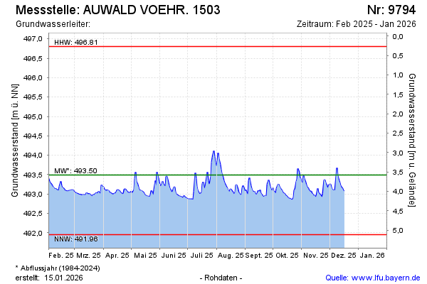
Current data AUWALD VOEHR. 1503
Groundwater level [m above sealevel]: 493.00
Distance to surface [m]: 4.07
Last value from 17.06.2026 13:00
Ground level [m above sealevel]: 497.07
| Date | Groundwater level [m above sealevel] |
|---|---|
| 17.06.2026 | 493.02 |
| 16.06.2026 | 493.03 |
| 15.06.2026 | 493.10 |
| 14.06.2026 | 493.20 |
| 13.06.2026 | 493.25 |
| 12.06.2026 | 493.17 |
| 11.06.2026 | 493.29 |
| 10.06.2026 | 493.13 |