
Current data AUGSBURG 597
Groundwater level [m above sealevel]: 487.97
Distance to surface [m]: 2.69
Last value from 03.06.2026 10:00
Ground level [m above sealevel]: 490.66
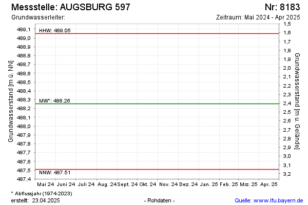
| Date | Groundwater level [m above sealevel] |
|---|---|
| 04.12.2024 | 488.10 |
| 01.07.2024 | 488.49 |
| 14.12.2023 | 488.48 |
| 17.01.2018 | 488.08 |
| 29.06.2017 | 488.13 |
| 14.12.2016 | 488.09 |
| 22.06.2016 | 488.23 |
| 10.06.2015 | 488.07 |