
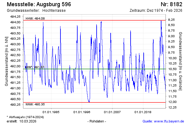
Chart of total period Augsburg 596
Groundwater level [m above sealevel]: 491,21
Distance to surface [m]: 11,16
Last value from 29.06.2026 07:13
Ground level [m above sealevel]: 502.37
| Date | Groundwater level [m above sealevel] |
|---|---|
| 29.06.2026 | 491.22 |
| 28.06.2026 | 491.22 |
| 27.06.2026 | 491.23 |
| 26.06.2026 | 491.24 |
| 25.06.2026 | 491.25 |
| 24.06.2026 | 491.26 |
| 23.06.2026 | 491.27 |
| 22.06.2026 | 491.29 |