
- Start >
- Groundwater >
- Waterlevel of upper layer >
- Bayern >
- AUF DER BURG 19 >
- Current data

Current data AUF DER BURG 19
Groundwater levels of the last 12 months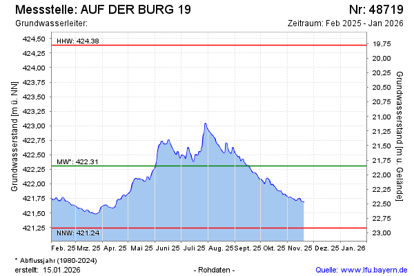
Groundwater level [m above sealevel]: 421.42
Distance to surface [m]: 22.74
Last value from 19.02.2026 08:46
Ground level [m above sealevel]: 444.16
| Date | Groundwater level [m above sealevel] |
|---|---|
| 19.02.2026 | 421.42 |
| 18.02.2026 | 421.42 |
| 17.02.2026 | 421.40 |
| 16.02.2026 | 421.38 |
| 15.02.2026 | 421.39 |
| 14.02.2026 | 421.40 |
| 13.02.2026 | 421.41 |
| 12.02.2026 | 421.42 |
© Bayerisches Landesamt für Umwelt 2026