
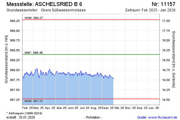
Current data ASCHELSRIED B 6
Groundwater level [m above sealevel]: 387.85
Distance to surface [m]: 18.9
Last value from 25.03.2026 14:00
Ground level [m above sealevel]: 406.75
| Date | Groundwater level [m above sealevel] |
|---|---|
| 25.03.2026 | 387.79 |
| 24.03.2026 | 387.69 |
| 23.03.2026 | 387.71 |
| 22.03.2026 | 387.75 |
| 21.03.2026 | 387.75 |
| 20.03.2026 | 387.72 |
| 19.03.2026 | 387.68 |
| 18.03.2026 | 387.67 |