
- Start >
- Groundwater >
- Waterlevel of upper layer >
- Bayern >
- Arbing B17 >
- Chart of total period

Chart of total period Arbing B17
Groundwater levels of the total period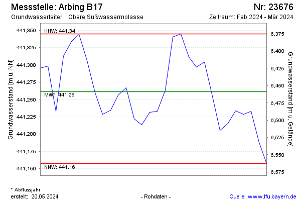
Groundwater level [m above sealevel]: 440.20
Distance to surface [m]: 7.52
Last value from 05.11.2025 12:00
Ground level [m above sealevel]: 447.72
| Date | Groundwater level [m above sealevel] |
|---|---|
| 05.11.2025 | 440.19 |
| 04.11.2025 | 440.17 |
| 03.11.2025 | 440.15 |
| 02.11.2025 | 440.17 |
| 01.11.2025 | 440.16 |
| 31.10.2025 | 440.15 |
| 30.10.2025 | 440.16 |
| 29.10.2025 | 440.16 |
© Bayerisches Landesamt für Umwelt 2025