
- Start >
- Groundwater >
- Waterlevel of upper layer >
- Bayern >
- Ansbach HW GWM 8 >
- Chart of total period

Chart of total period Ansbach HW GWM 8
Groundwater levels of the total period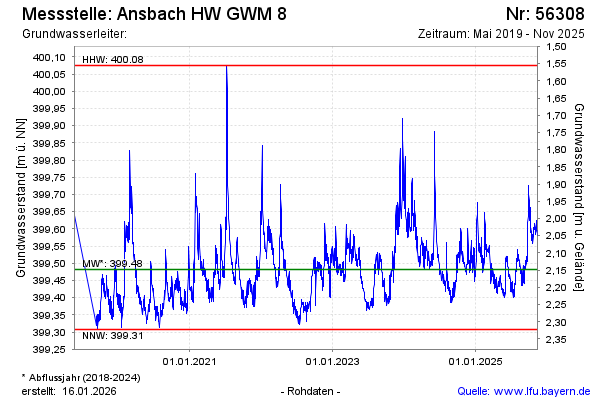
Groundwater level [m above sealevel]: 399.70
Distance to surface [m]: 1.93
Last value from 02.03.2026 11:48
Ground level [m above sealevel]: 401.63
| Date | Groundwater level [m above sealevel] |
|---|---|
| 02.03.2026 | 399.70 |
| 01.03.2026 | 399.71 |
| 28.02.2026 | 399.75 |
| 27.02.2026 | 399.78 |
| 26.02.2026 | 399.81 |
| 25.02.2026 | 399.86 |
| 24.02.2026 | 399.88 |
| 23.02.2026 | 399.88 |
© Bayerisches Landesamt für Umwelt 2026