
- Start >
- Groundwater >
- Waterlevel of upper layer >
- Bayern >
- Ansbach HW GWM 4 >
- Chart of total period

Chart of total period Ansbach HW GWM 4
Groundwater levels of the total period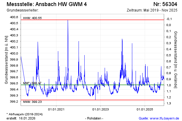
Groundwater level [m above sealevel]: 399.71
Distance to surface [m]: 0.76
Last value from 02.03.2026 11:15
Ground level [m above sealevel]: 400.47
| Date | Groundwater level [m above sealevel] |
|---|---|
| 02.03.2026 | 399.71 |
| 01.03.2026 | 399.73 |
| 28.02.2026 | 399.77 |
| 27.02.2026 | 399.81 |
| 26.02.2026 | 399.86 |
| 25.02.2026 | 399.98 |
| 24.02.2026 | 400.05 |
| 23.02.2026 | 400.05 |
© Bayerisches Landesamt für Umwelt 2026