
- Start >
- Groundwater >
- Waterlevel of upper layer >
- Bayern >
- ANNING_OP19 >
- Chart of total period

Chart of total period ANNING_OP19
Groundwater levels of the total period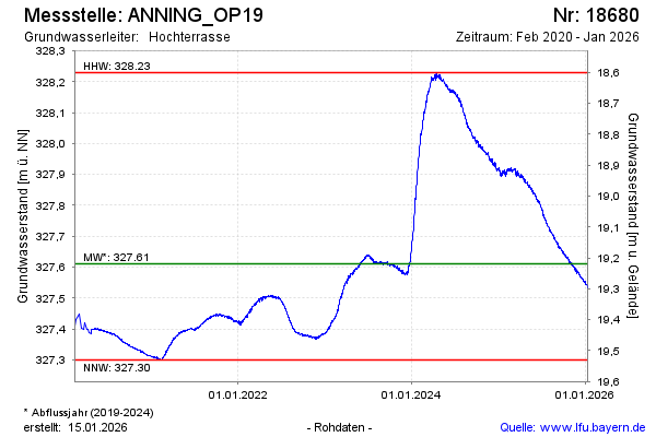
Groundwater level [m above sealevel]: 328.21
Distance to surface [m]: 18.62
Last value from 05.05.2024 08:00
Ground level [m above sealevel]: 346.83
| Date | Groundwater level [m above sealevel] |
|---|---|
| 05.05.2024 | 328.21 |
| 04.05.2024 | 328.21 |
| 03.05.2024 | 328.21 |
| 02.05.2024 | 328.22 |
| 01.05.2024 | 328.22 |
| 30.04.2024 | 328.21 |
| 29.04.2024 | 328.21 |
| 28.04.2024 | 328.21 |
© Bayerisches Landesamt für Umwelt 2024