
- Start >
- Groundwater >
- Waterlevel of upper layer >
- Bayern >
- AN DER BAHN 722 >
- Chart of total period

Chart of total period AN DER BAHN 722
Groundwater levels of the total period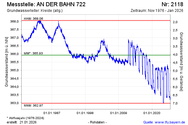
Groundwater level [m above sealevel]: 364.91
Distance to surface [m]: 5.06
Last value from 10.05.2026 04:00
Ground level [m above sealevel]: 369.97
| Date | Groundwater level [m above sealevel] |
|---|---|
| 09.05.2026 | 364.91 |
| 08.05.2026 | 364.92 |
| 07.05.2026 | 364.95 |
| 06.05.2026 | 364.97 |
| 05.05.2026 | 364.97 |
| 04.05.2026 | 364.96 |
| 03.05.2026 | 364.95 |
| 02.05.2026 | 364.93 |
© Bayerisches Landesamt für Umwelt 2026