
- Start >
- Groundwater >
- Waterlevel of upper layer >
- Bayern >
- AMTSGERICHT 12 >
- Chart of total period

Chart of total period AMTSGERICHT 12
Groundwater levels of the total period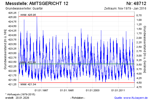
note
Die Messstelle musste 2016 zurück gebaut werden.
Groundwater level [m above sealevel]: 421.35
Distance to surface [m]: 4.50
Last value from 18.01.2016 12:50
Ground level [m above sealevel]: 425.85
| Date | Groundwater level [m above sealevel] |
|---|---|
| 18.01.2016 | 421.35 |
| 17.01.2016 | 421.39 |
| 16.01.2016 | 421.44 |
| 15.01.2016 | 421.42 |
| 14.01.2016 | 421.47 |
| 13.01.2016 | 421.51 |
| 12.01.2016 | 421.50 |
| 11.01.2016 | 421.44 |
© Bayerisches Landesamt für Umwelt 2026