
- Start >
- Groundwater >
- Waterlevel of upper layer >
- Bayern >
- ALTENSTEIG B7 787 >
- Year chart of precipitation

Year chart of precipitation ALTENSTEIG B7 787
Groundwater levels of the last 12 months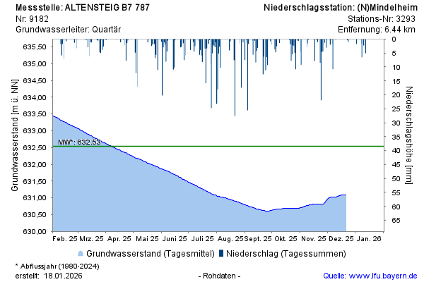
Groundwater level [m above sealevel]: 631,49
Distance to surface [m]: 6,58
Last value from 12.03.2026 04:00
Ground level [m above sealevel]: 638.07
© Bayerisches Landesamt für Umwelt 2026