
- Start >
- Groundwater >
- Waterlevel of upper layer >
- Bayern >
- Altenstadt, westl. Iller, km 29,6 >
- Current data

Current data Altenstadt, westl. Iller, km 29,6
Groundwater levels of the last 12 months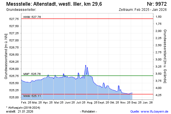
Groundwater level [m above sealevel]: 525.39
Distance to surface [m]: 3.94
Last value from 16.03.2026 11:38
Ground level [m above sealevel]: 529.33
| Date | Groundwater level [m above sealevel] |
|---|---|
| 16.03.2026 | 525.39 |
| 15.03.2026 | 525.39 |
| 14.03.2026 | 525.40 |
| 13.03.2026 | 525.40 |
| 12.03.2026 | 525.39 |
| 11.03.2026 | 525.39 |
| 10.03.2026 | 525.40 |
| 09.03.2026 | 525.41 |
© Bayerisches Landesamt für Umwelt 2026