
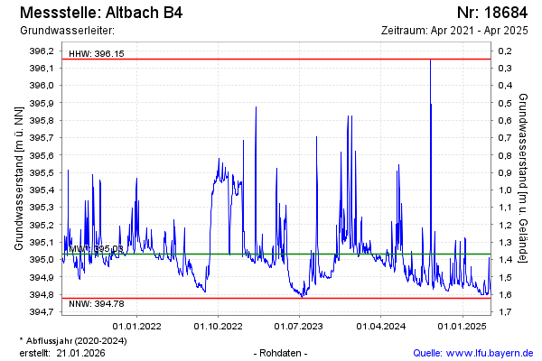
Chart of total period Altbach B4
Groundwater level [m above sealevel]: 394,81
Distance to surface [m]: 1,59
Last value from 07.04.2025 08:00
Ground level [m above sealevel]: 396.40
| Date | Groundwater level [m above sealevel] |
|---|---|
| 07.04.2025 | 394.81 |
| 06.04.2025 | 394.81 |
| 05.04.2025 | 394.82 |
| 04.04.2025 | 394.83 |
| 03.04.2025 | 394.84 |
| 02.04.2025 | 394.86 |
| 01.04.2025 | 394.89 |
| 31.03.2025 | 394.94 |