
Chart of total period Altbach B3
Groundwater level [m above sealevel]: 394,86
Distance to surface [m]: 1,01
Last value from 13.06.2025 08:09
Ground level [m above sealevel]: 395.87
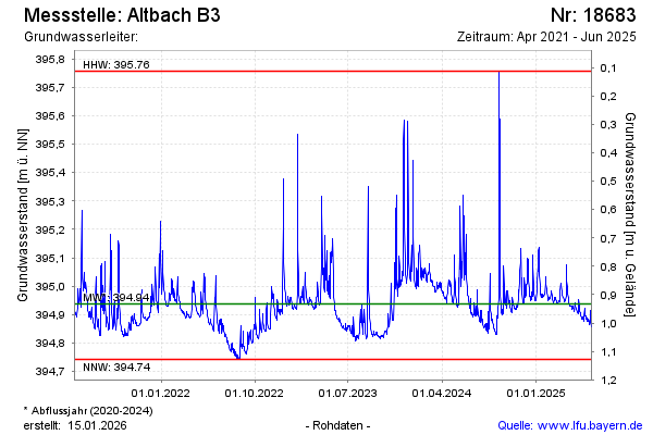
| Date | Groundwater level [m above sealevel] |
|---|---|
| 13.06.2025 | 394.86 |
| 12.06.2025 | 394.86 |
| 11.06.2025 | 394.86 |
| 10.06.2025 | 394.87 |
| 09.06.2025 | 394.89 |
| 08.06.2025 | 394.91 |
| 07.06.2025 | 394.88 |
| 06.06.2025 | 394.87 |