
Chart of total period Altbach B2
Groundwater level [m above sealevel]: 395.63
Distance to surface [m]: 0.73000000000002
Last value from 13.06.2025 08:01
Ground level [m above sealevel]: 396.36
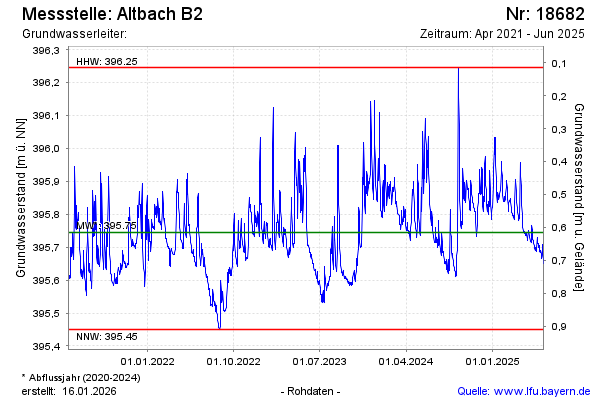
| Date | Groundwater level [m above sealevel] |
|---|---|
| 13.06.2025 | 395.65 |
| 12.06.2025 | 395.65 |
| 11.06.2025 | 395.67 |
| 10.06.2025 | 395.68 |
| 09.06.2025 | 395.69 |
| 08.06.2025 | 395.71 |
| 07.06.2025 | 395.68 |
| 06.06.2025 | 395.67 |