
- Start >
- Groundwater >
- Waterlevel of upper layer >
- Bayern >
- ALPENWEG 27 >
- Chart of total period

Chart of total period ALPENWEG 27
Groundwater levels of the total period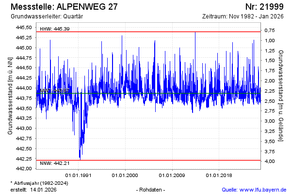
Groundwater level [m above sealevel]: 443.85
Distance to surface [m]: 2.33
Last value from 05.05.2024 10:00
Ground level [m above sealevel]: 446.18
| Date | Groundwater level [m above sealevel] |
|---|---|
| 05.05.2024 | 443.86 |
| 04.05.2024 | 443.87 |
| 03.05.2024 | 443.90 |
| 02.05.2024 | 443.93 |
| 01.05.2024 | 443.96 |
| 30.04.2024 | 443.96 |
| 29.04.2024 | 443.94 |
| 28.04.2024 | 443.91 |
© Bayerisches Landesamt für Umwelt 2024