
- Start >
- Groundwater >
- Waterlevel of upper layer >
- Bayern >
- ALLING 814 A >
- Chart of total period

Chart of total period ALLING 814 A
Groundwater levels of the total period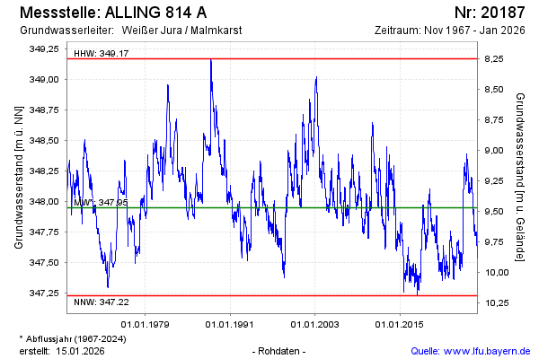
Groundwater level [m above sealevel]: 347.82
Distance to surface [m]: 9.60
Last value from 05.03.2026 10:00
Ground level [m above sealevel]: 357.42
| Date | Groundwater level [m above sealevel] |
|---|---|
| 05.03.2026 | 347.80 |
| 04.03.2026 | 347.80 |
| 03.03.2026 | 347.80 |
| 02.03.2026 | 347.79 |
| 01.03.2026 | 347.78 |
| 28.02.2026 | 347.78 |
| 27.02.2026 | 347.78 |
| 26.02.2026 | 347.77 |
© Bayerisches Landesamt für Umwelt 2026