
- Start >
- Groundwater >
- Waterlevel of upper layer >
- Bayern >
- ALLING 814 >
- Current data

Current data ALLING 814
Groundwater levels of the last 12 months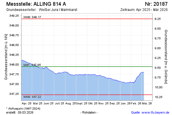
Groundwater level [m above sealevel]: 348.32
Distance to surface [m]: 9.04
Last value from 23.07.2024 10:00
Ground level [m above sealevel]: 357.36
| Date | Groundwater level [m above sealevel] |
|---|---|
| 23.07.2024 | 348.31 |
| 22.07.2024 | 348.30 |
| 21.07.2024 | 348.31 |
| 20.07.2024 | 348.32 |
| 19.07.2024 | 348.32 |
| 18.07.2024 | 348.33 |
| 17.07.2024 | 348.33 |
| 16.07.2024 | 348.33 |
© Bayerisches Landesamt für Umwelt 2024